What you will find in this article
What structures Slovak Maya experts uncovered in the Guatemalan jungle
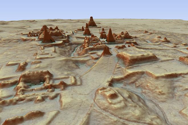
What is LiDAR
How the latest findings change the view of current knowledge about the ancient Mayas
What Maya agriculture looked like
What may have caused the collapse of the Maya civilisation
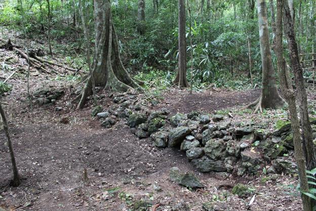
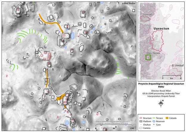
Slovak archaeologists were passing a manmade stone line in a dense Guatemalan jungle on their way from the camp for years. They thought that maybe it used to be a wall of a Maya water reservoir or a pool that used be there during a period of rain in the past. Only thanks to the new laser scanning technology did they find out that it is part of what used to be a terrace field. It is one of almost 5,000 such fields they identified over 160 square kilometres.
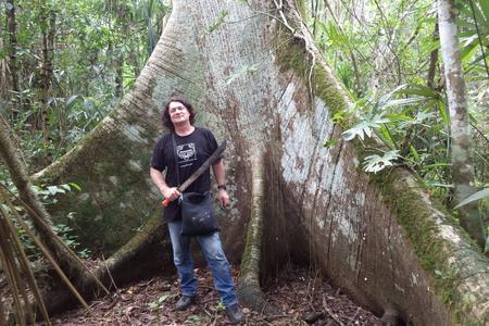
“This is actually one of the keys to understanding Maya agriculture,” said Milan Kováč, a Maya expert who has been examining Maya culture for more than 20 years. “Nobody before had any clue, not even us, about the existence of these fields, despite making archaeological excavations for years. We were just too close. The new technology enables us to see the area in context.”
The findings of Kováč’s expert team is part of what is hailed as a major breakthrough in Maya archaeology, about which National Geographic recently informed readers. Researchers have identified ruins of more than 60,000 houses, palaces, elevated highways and other human-made structures hidden for centuries under the jungles of northern Guatemala. The results suggest that the Mayas were an advanced civilisation comparable more to sophisticated cultures such as ancient Greece or China than the scattered and sparsely populated city states ground-based research had long suggested.
Slovaks examining Maya civilisation
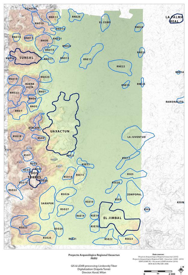
Kováč, from the Faculty of Arts of the Comenius University, and his multi-disciplinary team, have been doing research on the political and environmental context of Uaxactun in Guatemala since 2009. They hold an archaeological license for 1,600 square kilometres. In 2016 they joined the Pacunam LiDAR Initiative (PLI) consortium. The other four partners are Boston University, Tulane University, Ithaca College, and Sorbonne University. As the only team they have made their own excavations on site, giving them an advantage when interpreting obtained digital data.
Within this project they have surveyed 160 square kilometres with LiDAR (Light Detection And Ranging) aerial mapping technology.