

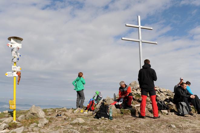
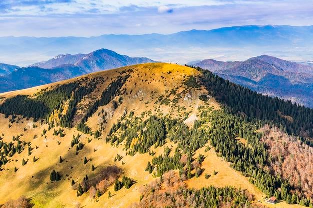
 Hikers relax at the top of the Minčol peak. (source: TASR)
The Tatras have long enjoyed more publicity than the neighbouring Fatras, though the latter provides hikers with equally scenic views and adventures.
A few months ago, the Turčianska Záhradka project, founded by Branislav Šimko, announced a new hiking challenge – Koruna Turca – to promote peaks in the mountain ranges, including Malá Fatra and Veľká Fatra, that surround the Turiec region.
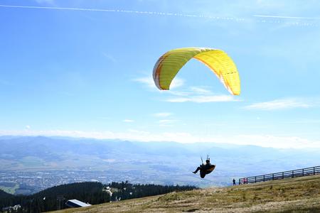
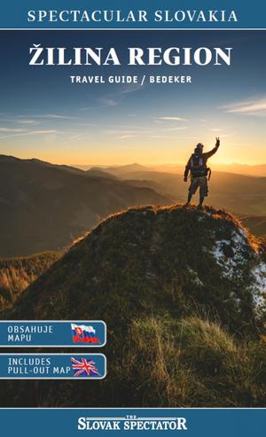 Find out more about region of folklore, national parks and modern attractions in our Žilina Region Travel Guide. (source: Spectacular Slovakia)
“Koruna Turca is a challenge after which you will have walked more than 200 km with an elevation gain of more than 10,000 m,” Šimko wrote in his blog. The local described it as “a hiking massacre”.
He explained that hikers can walk across five mountain ridges: Krivánska Malá Fatra, Lúčanská Malá Fatra, Veľká Fatra, Žiar and Kremnické Vrchy.
When hikers come to the region, they often set out on hikes to popular peaks such as Ostrá and Tlstá or Chleb. But in last year’s challenge, Šimko called on people to hike 21 lesser-known hilltops in Turiec.
Šimko’s latest hiking recommendations come with tips on where to begin a hike, where to sleep overnight, where to find drinking water in the hills, and what to watch out for.
1| Krivánska Malá Fatra
Track: Šútovo (village) – Šútovo Waterfall – Chleb – Kriváň (s) – Suchý – Chata pod Suchým (hut) – Strečno (village) – Saračníky – Minčol – Martinské Hole
Length: 38 km
Where to eat: Chata pod Chlebom, Chata pod Suchým, Strečno, Martinské Hole (Javorina)
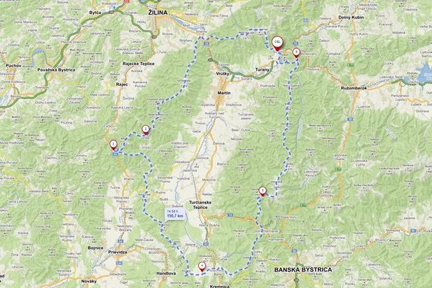 A loop trail that takes hikers around the Turiec region. (source: Turčianska Záhradka)
Where to sleep: Experienced hikers can complete the track in one day. Otherwise, hikers can spend the night at mountain huts. The Vendovka shelter can be found near the Malý Kriváň peak.
Spring: a spring at the Pekelník peak (It is better to refill bottles at huts, though.)
Potential problems: weather changes and water
2| Lúčanská Malá Fatra
Track: Martinské Hole – Veterné – Horná Lúka – Hnilická Kýčera – Kľak – Fačkovské Sedlo
Length: 28.5 km
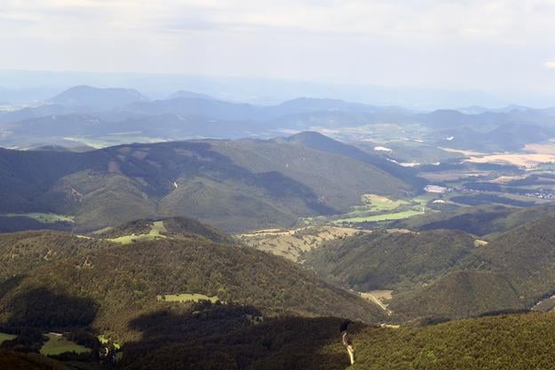 A view of the Rajec Valley up from the Kľak peak. (source: Peter Dlhopolec/TSS)
Where to eat: no places to eat
Where to sleep: a sleeping bag, Koliba at Fačkovské Sedlo, a small shelter made of branches below Hnilická Kýčera
Spring: 2 minutes from a hiking trail sign below Hnilická Kýčera
Potential problems: sleeping place, water, food, bears
3| Žiar
Track: Fačkovské Sedlo – Vrícke Sedlo – Závozy – Hadviga (declined German settlement) – Vyšehrad – forests above Budiš (village) – forests above Dubové (village) – Sklené (village)
Length: 41 km
Where to eat: no places to eat
Where to sleep: no shelters
Springs: a spring in the Repeš BBQ area near the village of Brieštie (5 minutes from a hiking trail), springs near the Štyri Chotáre hut, in the Jalové Lazy cottage area, and near woodsman’s cottages below the Malý Vyšehrad peak and the Chrenovské Lazy cottage area
Potential problems: most of the hike is through forests, lack of beautiful views
4| Kremnické Vrchy
Track: Sklené – Bralova Skala – Kozie Chrbty – Vysoká – meadows near the village of Kunešov – Kremnické Bane (village) and John the Baptist’s Church (heart of Europe) – Krahule (village) – Skalka – Vyhnatová – Kordický Štít – Svrčinník – Malý Šturec (saddle) – Hotel Kráľova Studňa
Length: 50 km
Where to eat: Kunešov (grocery store), Krahule (bar/restaurant), Skalka
Where to sleep: small shelters near Kunešov, Görgei’s Tunnel, and close to Šturec, and Hotel Kráľova Studňa
 A deck chair below the Skalka viewing platform outside Banská Bystrica. A few metres away from the deck chair, hikers can find a spot named after the Titanic. (source: The Slovak Spectator)
Springs: near the Kunešov shelter, Krahule, Skalka, near the Cabanka hut, Kráľova Studňa
Potential problems: wild animals, a long track (It is better to split it into two days.)
5| Veľká Fatra
Track: Kráľova Studňa – Krížna – Ostredok – Ploská – Borišov – Šoproň – Malý Lysec – Jarabiná – Kľak – Ľubochnianske Sedlo – Kopa – Krpeľany (village) – Šútovo (village)
Length: 50 km
Where to eat: Chata pod Borišovom (hut)
Where to sleep: several shelters (Salaš below the Suchý Vrch peak, Salaš Mandolína, Príslop above the village of Nolčovo), Chata pod Borišovom
 The Borišov peak in the Veľká Fatra mountains. (source: TASR)
Springs: a well below the Ploská peak, Borišov, a well below the Jarabiná peak, springs near the Príslop shelter and below the Nižná Lipová peak, Ľubochnianske Sedlo, a spring below the Kopa peak
Potential problems: Experienced hikers can complete the track in one day. Otherwise, hikers can spend the night at the hut below Borišov. Šimko also warns of wild animals and fallen trees between Malý Lysec and Kľak.
Spectacular Slovakia travel guides
A helping hand in the heart of Europe thanks to the Slovakia travel guide with more than 1,000 photos and hundreds of tourist spots.
Detailed travel guide to the Tatras introduces you to the whole region around the Tatra mountains, including attractions on the Polish side.
Lost in Bratislava? Impossible with our City Guide!
See some selected travel articles, podcasts, traveller's needs as well as other guides dedicated to Nitra, Trenčín Region, Trnava Region and Žilina Region.
