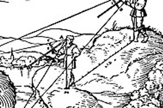
The surveyors at work in the 18th century.
photo: Courtesy of SNM
THE FIRST detailed and complete mapping of the current Slovak territory was carried out between 1782 and 1784, during the First Military Mapping of the Hungarian monarchy. Cartogra-phers from the Austrian army produced 210 maps, each measuring 64 by 42 centimetres, to a scale of 1:28,800.
The coloured, hand-drawn originals emblazoned with legends are deposited in the state archive in Vienna, but were first displayed in public only in 2003.
The exhibition, which was shown at the Museum of Carpathian German Culture, will be repeated in Bratislava and Kežmarok sometime in 2006.
The maps reflect a true picture of Slovakia from before the Industrial Revolution. They show the towns and villages occupied by German inhabitants, the ancestors of the present Carpathian Germans living in Slovakia and abroad. The Germans settled in three regions: Bratislava and surroundings, Central Slovakia - the Kremnica and Pravno areas (Hauerland), and Spiš - the Bodva River valley.
An integral part of the maps are the military descriptions of individual settlements, which were identified by this First Military Mapping. The maps reflect the military, topo-graphical, geographical and economic infrastructure of Slovak towns, villages and their markets.
The specific data on the settlements, buildings, rivers, woods, meadows, roads and hills is an unexplored geo-historical source that could act as a huge database for researchers in diverse fields.
The military descriptions are limited to the settlements and close surroundings that were of military interest to the Habsburg monarchy.
A fascinating feature of the maps is the original names of the municipalities and towns in their Slovak, German and Hungarian versions. The maps high cartographic and artistic value, as well as the descriptions produced by the 18th century cartographers, make them a precious part of Slovakia's national cultural heritage.
Author: Bohuš Klein
