

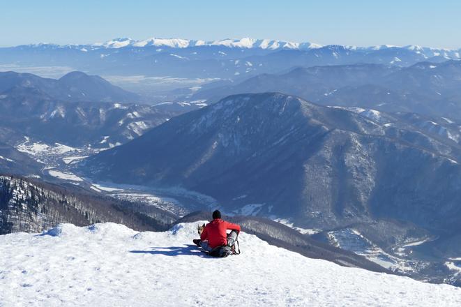
 A tourist relaxes on the Chleb peak in the Malá Fatra mountain range. (source: TASR/Erika Ďurčová)
A year after an aerial video-map of the High Tatras was released, the Slovensko z neba air group has published another map of the same kind, showing the beauty of the Krivánska Malá Fatra region.
The video-map incorporates geographical descriptions, the names of municipalities and interesting tourist places.
The region spreads out between the villages Strečno and Zázrivá, and hikers can find peaks such as Veľký Kriváň, Malý Kriváň, Chleb, Veľký Rozsutec and Stoh. A large part of the area is, in fact, a national park.
The 30-minute aerial documentary shows a hiking trail through the ridge of Malá Fatra, the Domašín Meander as well as the cities of Žilina and Martin.
Spectacular Slovakia travel guides
A helping hand in the heart of Europe thanks to the Slovakia travel guide with more than 1,000 photos and hundred of tourist spots.
Detailed travel guide to the Tatras introduces you to the whole region around the Tatra mountains, including attractions on the Polish side.
Lost in Bratislava? Impossible with our City Guide!
See some selected travel articles, podcasts, traveller's needs as well as other guides dedicated to Nitra, Trenčín Region, Trnava Region and Žilina Region.
