

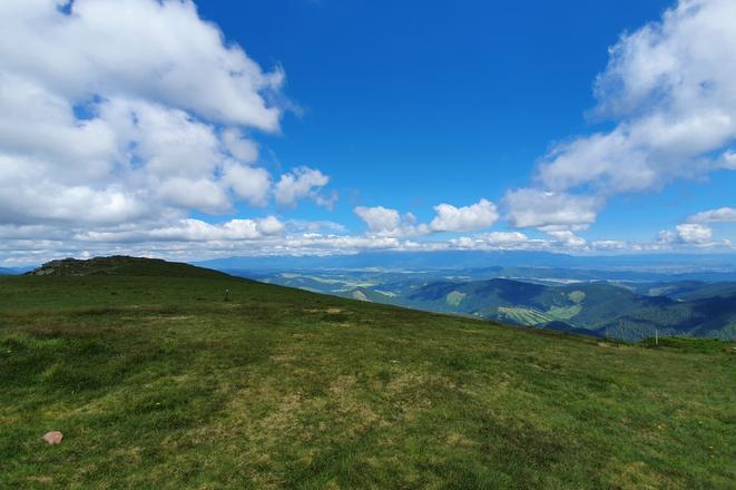
 A view from Kráľova Hoľa towards the Tatras. (source: Radka Minarechová)
Kráľova Hoľa hill is one of the most-featured places in Slovak legends and songs and there is a reason for this. It offers a panoramic view of several mountain ranges, making you feel like you are on top of the world.
 A helping hand in the heart of Europe offers for you Slovakia travel guide.
Rising to an altitude of 1,946 metres above sea level, it is the highest point of the eastern part of the Low Tatras. There are several hiking trails leading to the place from both the Liptov and the Horehronie regions and one can even reach it via a cycling path.
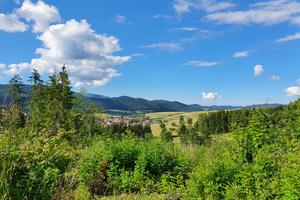
When visiting Horehronie, there are two places from which you can start your trip: Šumiac or Telgárt. The latter is part of the longest trail in Slovakia.
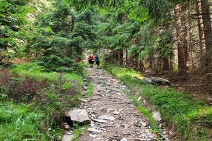
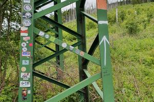
Starting from Telgárt’s square, follow the red sign that will take you through the forest and then the meadow up to the transmitter on Kráľova Hoľa. This trail is part of the Cesta Hrdinov SNP (the Path of the Heroes of the Slovak National Uprising), or the SNP Trail, which is 760km long and stretches from Devín in the west to the Dukla pass in the east.
The red-marked trail is a bit demanding, and you should prepare for some steep ascents as the elevation difference exceeds 1,060 metres.
But the reward at the end of the hike is a magnificent view of the surrounding mountain ranges. On one side (and if the weather is cloudless) you can see the Western and High Tatras, as well as Kozie Chrbty, Spišská Magura and Levočské Vrchy in the Spiš region. Looking towards the opposite side, one can see Stolické Vrchy, Muránska Planina, and even Malá Fatra.
Telgárt – Kráľova Hoľa – Telgárt
Length: 12.9 km
Duration: app. 5:35h
Elevation difference: 1,061 m (between Telgárt and Kráľova Hoľa)
One option on the way back is to follow the green mark that leads towards Kráľova Skala (1,690 metres above sea level), which also offers great views, and then head back to Telgárt.
Hikers should watch out for the marks as it is sometimes a bit hard to find them. Also, the last 40 minutes are a steep downhill.
Two things to note:
When hiking with children, fellow hikers recommend the trail from the starting point in Horehronie, Šumiac. Just follow the blue mark.
It is also possible to rent an e-bike from Šumiac as there is an asphalt road leading to the transmitter.
Spectacular Slovakia travel guides
A helping hand in the heart of Europe thanks to the Slovakia travel guide with more than 1,000 photos and hundred of tourist spots.
Detailed travel guide to the Tatras introduces you to the whole region around the Tatra mountains, including attractions on the Polish side.
Lost in Bratislava? Impossible with our City Guide!
See some selected travel articles, podcasts, traveller's needs as well as other guides dedicated to Nitra, Trenčín Region, Trnava Region and Žilina Region.
